


Computer Vision Techniques

Computer Vision Techniques
Computer Vision Techniques

Certified Digital Transformation Specialist Course
Digital Transformation Strategy Program
Certified Digital Transformation Leader Course
PEGA Certified Digital Business Analyst
PEGA Certified Digital Systems Analyst
Emerging Technologies and Artificial Intelligence

Technical tools for digital transformation
Intelligent electronic automation solutions


Use Case Description:
The platform aims to monitor and treat visual distortions in cities such as random waste, damaged paintings, or unwanted graffiti, in order to enhance the aesthetics of cities and raise the quality of life. The platform analyzes images taken through a camera mounted on a vehicle that is constantly on the roads, with the ability to locate and record each detected visual distortion case. The platform’s training process is done by providing it with images that include various visual distortions that have been previously detected in ways Traditional.
How it works:
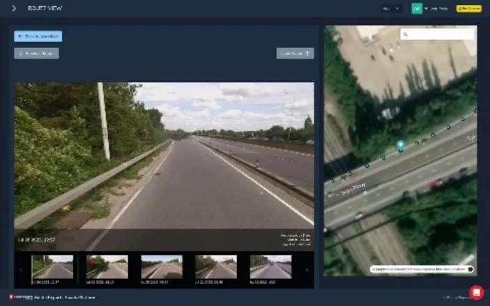
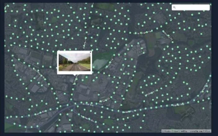
A 360-degree camera is installed on the designated vehicle, and then the vehicle is driven on the targeted roads. While the vehicle is moving, the camera takes peripheral images of the road and then these images are sent to the processing server that processes and analyzes the transmitted images with artificial intelligence (computer vision algorithms). When the deformation is detected, the necessary data such as (location, road name, type of deformation… etc.) in special databases, and a report for each route for which the survey was conducted is generated and submitted to the competent department to take the necessary actions.
Benefits:
Target Audience:
Internal Beneficiary (Employees) and External Beneficiary (Emiratis)
Use Case Description:
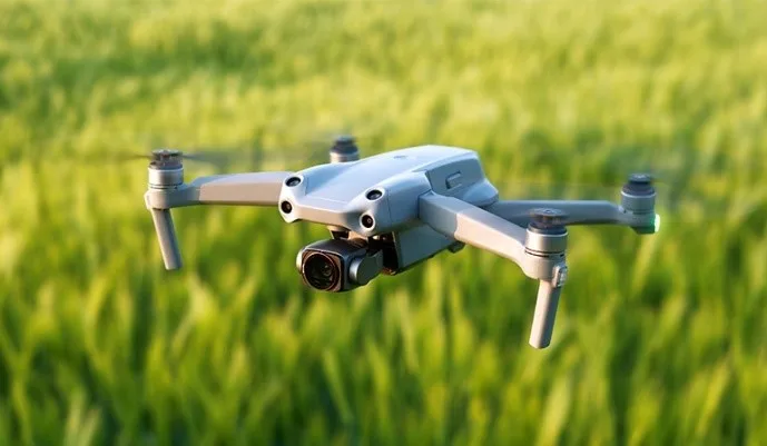
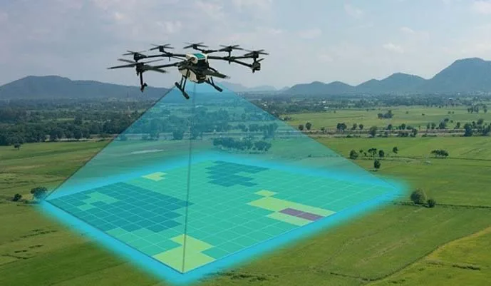
A platform for managing green spaces using drones equipped with surveillance cameras and using artificial intelligence technologies. The platform aims to monitor and maintain public parks and green spaces with high efficiency, by conducting a general survey of green spaces in cities and then analyzing the images and data extracted from them. The platform relies on modern technologies to monitor the health of green spaces and plants and confirm the quality of the irrigation system. The platform is trained by providing them with ancient historical data that includes problems discovered in a traditional way.
How it works:
Drones equipped with cameras conduct a general survey of green areas within the target area, the images are sent to a processing server whose function is to process and analyze the images using computer vision algorithms, a report is generated for all the problems detected after the analysis and the proposed recommendations are presented in a report to be presented to decision-makers and help them take appropriate action.
Benefits:
Target Audience:
Internal Beneficiaries (Local Administrations, Public Park Maintenance Companies)
Use Case Description:
A platform for road maintenance using artificial intelligence, which aims to improve the quality of road networks by automatically monitoring defects such as potholes and cracks, in order to enhance the efficiency of roads and raise the quality of life, by taking photos through cameras installed on a dedicated vehicle that drives permanently on the roads, with the ability to locate and record each defect discovered on the road. The platform is trained by providing it with cases of defects previously discovered by traditional methods.
How it works:
A camera is installed on a dedicated vehicle, the vehicle drives on the targeted roads to detect its defects, while the vehicle is moving, the camera takes pictures of the road, then the images are sent to the processing server, the processing server processes the images sent to it and analyzes them with artificial intelligence technology (computer vision algorithms), when the defect is detected, the necessary data is saved such as (location, road name, type of defect… etc.), then a report is generated for each road that has been surveyed to be submitted to the competent department to take the necessary measures.
Benefits:
Target Audience:
Internal beneficiaries (local administrations, road maintenance companies)